
YOUR FORECAST:
TDY: VARIABLY CLOUDY – MID 40S
TNTE: CLOUDY- SOME DRIZZLE – HOLDING IN 40S
SAT: VERY MILD – SOME RAIN- 55-60 (RECORD HIGH 60 – 1983)
SUN: SHOWERS AND WINDY- LOWER 60S (RECOERD HIGH 60 – 2018)
MON: PARTLY SUNNY – MID 40S
WEATHER TRIVIA: 1975 – MINNESOTA’S STORM OF THE CENTURY: 24” OF SNOW WITH WIND CHILLS OF 50 TO 80 BELOW ZERO

Above...today's map shows a cold front mid section of Nation. Warm ahead o if it with rain...cold with snow behind it. Below - this is what the map will look like on Sunday as cold front swings off East Coast.

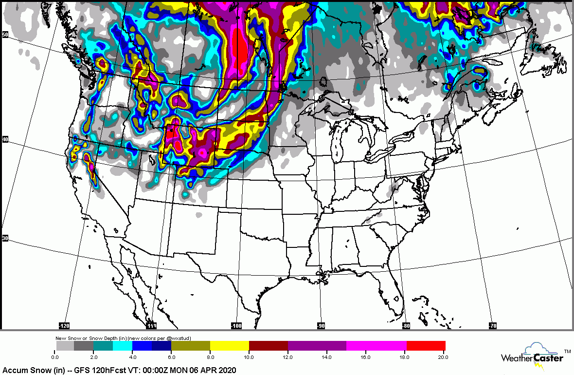
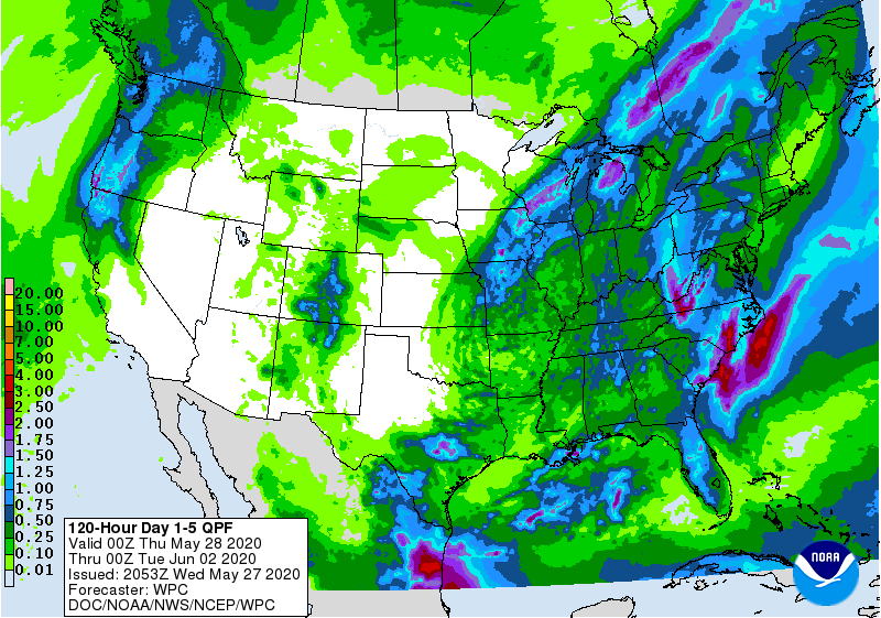
Below - snowfall and rainfall predictions through Tuesday.


Below - early a.m. satellite and radar depicting that cold front in
Plains.

Below - expected temperatures by next Thursday as the North begins to chill down from West to East. Have a nice and safe weekend.


Susan Silver was one of the first female TV comedy writers, with credits like The Mary Tyler Moore Show, Maude, and Bob Newhart, among...
